Fire lookout · Oconto County, Wisconsin
Mountain Lookout Tower
Aermotor tower erected 1932 by the Wisconsin Conservation Commission at a site about 2.5 miles away, moved by CCC to its present Oconto County site in 1935; open to climb May to November.
- Standing
- Open to the public
- Verified
Visit & stay
Not rentable. As far as we know, this lookout cannot be booked for overnight stays.
Access
Open to the public. Open May 1 to November 1, daily 8 a.m. to sunset; visitors may climb to the top. Forest Service site.
- Can you climb it?
- Yes
- Road to the top?
- Yes, you can drive up
- Trail
- Gravel road runs uphill to a parking area just north of the tower; visitors climb the stairs to the cab
- Staffing
- Unknown
Facts
- Status
- sources disagree
- Type
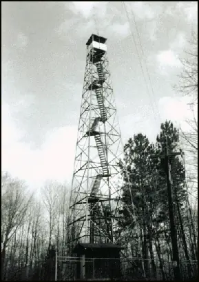
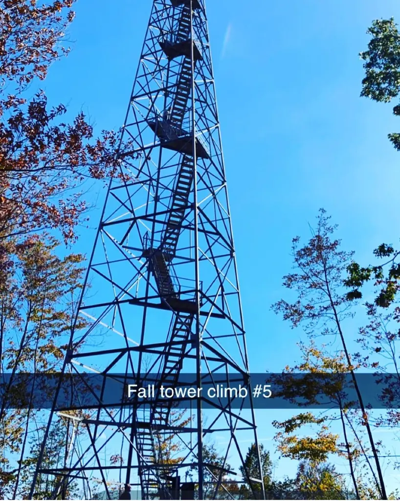
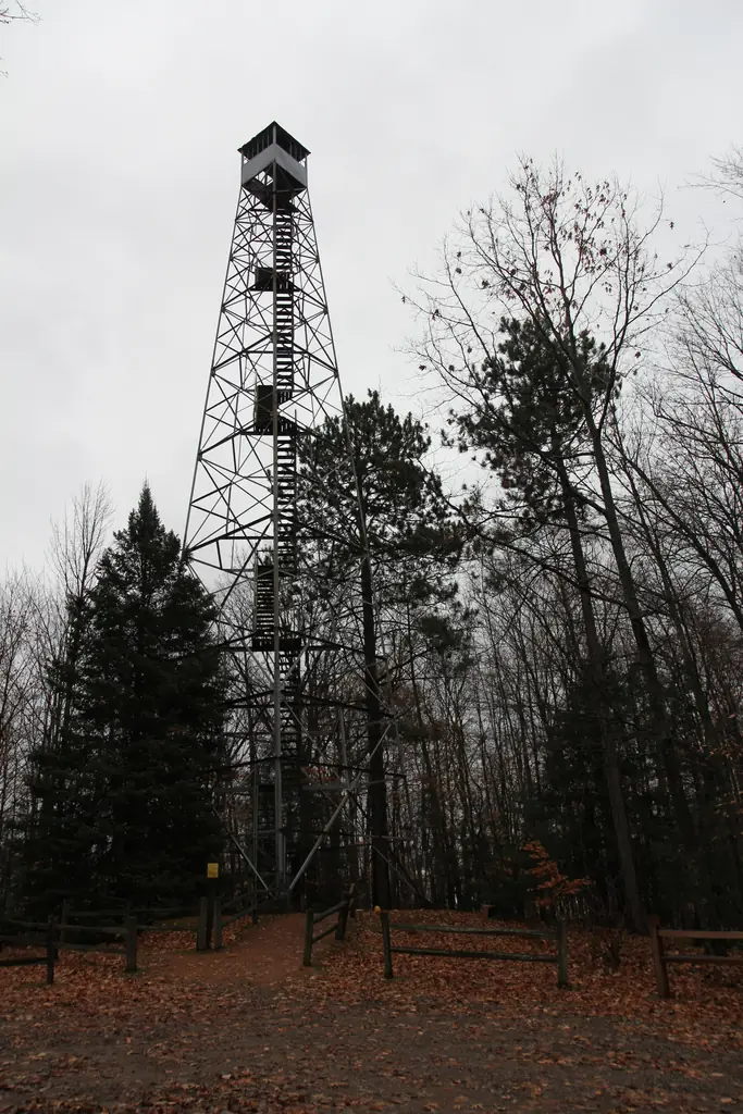
- Cab on a towerGalvanized steel Aermotor LS-40 tower on four concrete piers, about 100 ft tall, with a 7x7-ft cabThe design: Aermotor LS-40
- Built of
- Steel
- Built
- 1932
- Height
- 100 ft (30.5 m)
- Elevation
- 1,254 ft (382 m)
- Agency
- U.S. Forest Service (Chequamegon-Nicolet National Forest, Lakewood-Laona Ranger District)
- Land
- Federal land
- Location
- Oconto County, Wisconsin
- Coordinates
- 45.21532, −88.46419
- Registers
- This entry
- VerifiedResearched, then checked independently. Updated 8 Oct 2026.
- Firefinder id
us-wi-mountain-lookout-tower
View from the cab
What you see from the cab: every ridge out to about 93 miles, the named peaks in sight, and other fire lookouts within view, worked out from terrain data in your browser.
Downloads about 3.9 MB of terrain data the first time.
Or see what it could see on the map: the ground in its line of sight.
History
Then and now
- 1932 BuiltPrefabricated by Aermotor in 1932 and erected by the Wisconsin Conservation Commission at its original site about two and a half miles away; pier dated 10/22/32Source: npgallery.nps.gov
- 1935 MovedCCC crews dismantled the tower and are believed to have rebuilt it at its present site; Forest Service bought the site 17 January 1935Source: npgallery.nps.gov
- 1940 StaffedFormer CCC enrollee Marvin P. Heisler recalled staffing the tower in 1940Source: npgallery.nps.gov
- No record between 1940 and 1970
- 1970 FireLast fire called in from the tower, 25 April 1970Source: npgallery.nps.gov
- 1977 AlteredRadio antenna and relay shelter added by the Oconto County City Ambulance and Law Enforcement Committee; both removed 1993 or 1994Source: npgallery.nps.gov
- No record between 1977 and 1992
- 1992 Added to the National Historic Lookout RegisterRegistered May 21, 1992 as US 41, WI 1Source: nhlr.org
- 1993 RestoredRehabilitated as an interpretive site 1993-94: deteriorated wooden components replaced, steel bracing and rails added, six interpretive panels placedSource: npgallery.nps.gov
- No record between 1993 and 2008
- 2008 Listed on the National Register of Historic PlacesAdded to the National Register of Historic Places August 19, 2008 (ref. 08000790)Sources: en.wikipedia.org, npgallery.nps.gov
- 2015 RestoredRestored 2015-16 with financial help from the Oconto County Economic Development Corporation and more than 500 hours of Forest Service employee workSource: fs.usda.gov
- TodayStandingIt still stands, as far as our sources know.
Old maps of this spot
USGS topographic maps from the years a lookout stood may show it, often as a small symbol labelled “Lookout”. See the old topo maps around it on the Firefinder map, or find every scanned sheet of this spot on USGS TopoView (opens another site) (click the spot there to list them, with dates and downloads).
Story
Researched 8 Oct 2026, fact-checked.
Mountain Fire Lookout Tower stands in Oconto County, Wisconsin, about two and a half miles north of the community of Mountain, off Old Highway 32.1,2 The tower's first life began in 1932, when the Aermotor company prefabricated it and the Wisconsin Conservation Commission erected it at another spot in the national forest, about two and a half miles away.3 A pier at that original site is dated October 22, 1932.3
The old spot was hard to reach, accessible only by a foot trail.3 In 1935 Civilian Conservation Corps crews took the tower apart, and they are believed to have rebuilt it at its present site.3 The Forest Service bought that ground from the Holt Lumber Company in January 1935.3
The Forest Service and Wikipedia both date the tower to 1935, the year it was moved, while the nomination dates the first erection to 1932.1,2,3
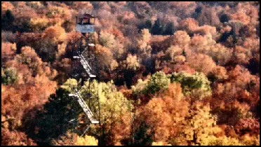
The tower is an Aermotor LS-40 model, resting on four concrete piers.3 It is about 100 feet tall, with a seven-by-seven-foot cab at the top.3,1
A local camp is believed to have supplied the labor that moved the tower, and camp enrollees manned the lookout and fought fires nearby.3 One former enrollee recalled staffing it in 1940.3
The tower kept serving through the 1960s, when aircraft spotting took over.3 The nomination gives April 25, 1970, as the date of the last fire called in from the tower.3
A radio antenna went up in 1977, along with a relay shelter at the base.3 Both were removed in 1993 or 1994.3 The tower was rehabilitated as an interpretive site in 1993 and 1994, when decayed wooden parts were replaced and six interpretive panels went up at its base.3
The forest says the tower was restored in 2015 and 2016 with local help and more than 500 hours of staff work.1
The National Historic Lookout Register listed the tower on May 21, 1992.4 The National Register of Historic Places added it on August 19, 2008.2,5 The register calls it the only remaining lookout on the forest, while the nomination counts it as one of two remaining towers out of the 19 that once served the forest.4,3
The forest calls it the first Wisconsin lookout on both registers.1 That is not quite right for the National Register, since the Fifield tower was added in 2007, a year before this one.1,6
Today the tower is open from May 1 to November 1, daily from 8 a.m. to sunset.1 It is the only one of the forest's 14 original towers that visitors may climb to the top.1
- Mountain Fire Lookout Tower, Chequamegon-Nicolet National Forest, USDA Forest Service, https://www.fs.usda.gov/r09/chequamegon-nicolet/recreation/mountain-fire-lookout-tower (accessed 2026-10-08). ↩
- Mountain Fire Lookout Tower, Wikipedia, https://en.wikipedia.org/wiki/Mountain_Fire_Lookout_Tower (accessed 2026-10-08). ↩
- Mountain Fire Lookout Tower, National Register of Historic Places registration form, National Park Service, https://npgallery.nps.gov/GetAsset/89eec880-bf4f-48b0-81a3-47d7a3a91ac0 (accessed 2026-10-08). ↩
- Mountain Lookout Tower, National Historic Lookout Register, http://nhlr.org/lookouts/us/wi/mountain-lookout-tower/ (accessed 2026-10-08). ↩
- Mountain Fire Lookout Tower, National Park Service NRHP asset record (NRIS 08000790), https://npgallery.nps.gov/AssetDetail/NRIS/08000790 (accessed 2026-10-08). ↩
- Fifield Fire Lookout Tower, Wikipedia, https://en.wikipedia.org/wiki/Fifield_Fire_Lookout_Tower (accessed 2026-10-08). ↩
Photos

Photos keep their own rights and are shown with credit. Is one of these yours? You can ask for a different credit or for removal.
Where sources disagree
We show disagreements between sources instead of quietly picking one. If you know which is right, please tell us.
Sources disagree on whether it still stands.
- FFLA: Standing
- NHLR: Standing
- FOREST LOOKOUTS -- central US (centraluslookouts.weebly.com): Gone
NHLR lists lookouts that were standing when registered.
Sources
- National Historic Lookout Register (NHLR) (opens another site) Gave us: name, location, county, elevation, what it is built of, register numbers, agency, ownership, dates, photos, links National Historic Lookout Register (nhlr.org) · All rights reserved (American Resources, Inc.); facts extracted only, no prose copied. · retrieved 4 Oct 2026
- Forest Fire Lookout Association (FFLA) - US lookout lists (opens another site) Gave us: type, status, register numbers, links Forest Fire Lookout Association (firelookout.org) · No licence stated; facts extracted only, no prose copied. · retrieved 8 Oct 2026
- FOREST LOOKOUTS -- central US (centraluslookouts.weebly.com) (opens another site) Gave us: design, links centraluslookouts.weebly.com · No licence stated; facts only (county, coordinates where the page's own map widget gives them, status, height, design hints, register links). The site's own historical quotes, newspaper citations and narrative are not reproduced. · retrieved 8 Oct 2026
- Wikidata -- US fire lookout towers (Q748998 and subclasses) (opens another site) Gave us: register numbers, dates, photos, links Wikidata · CC0 1.0 (Wikidata). Images keep their own Commons licence/credit. · retrieved 4 Oct 2026
- OpenStreetMap -- fire lookout structures (opens another site) Gave us: links © OpenStreetMap contributors · ODbL 1.0. (c) OpenStreetMap contributors. · retrieved 4 Oct 2026
- Firefinder research Gave us: summary, design, height, status, agency, access, visiting details, dates, links, fact-check Firefinder research (sources cited in the story footnotes) · Our own research notes; each fact cites its source in the lookout's story
More about this lookout elsewhere
- NHLR register entry US 41 (nhlr.org) (opens another site)
- NHLR register entry (nhlr.org) (opens another site)
- Mountain Fire Lookout Tower (Chequamegon-Nicolet National Forest, USDA Forest Service) (opens another site)
- Mountain Fire Lookout Tower, National Register of Historic Places registration form (National Park Service) (opens another site)
- Mountain Fire Lookout Tower (NRIS 08000790) asset record (National Park Service) (opens another site)
- Fifield Fire Lookout Tower (Wikipedia) (opens another site)
- FFLA Wisconsin lookout list (firelookout.org) (opens another site)
- Wikipedia: Mountain Fire Lookout Tower (opens another site)
- Mountain (centraluslookouts.weebly.com) (opens another site)
- Wikidata item Q6924944 (opens another site)
- OpenStreetMap node 353894244 (opens another site)
Firefinder takes facts (places, dates, numbers) from these sources and writes its own words. See all sources and licences.